


Bengali geologist solves the Himalayan puzzle at last - when will the mountains stop rising?

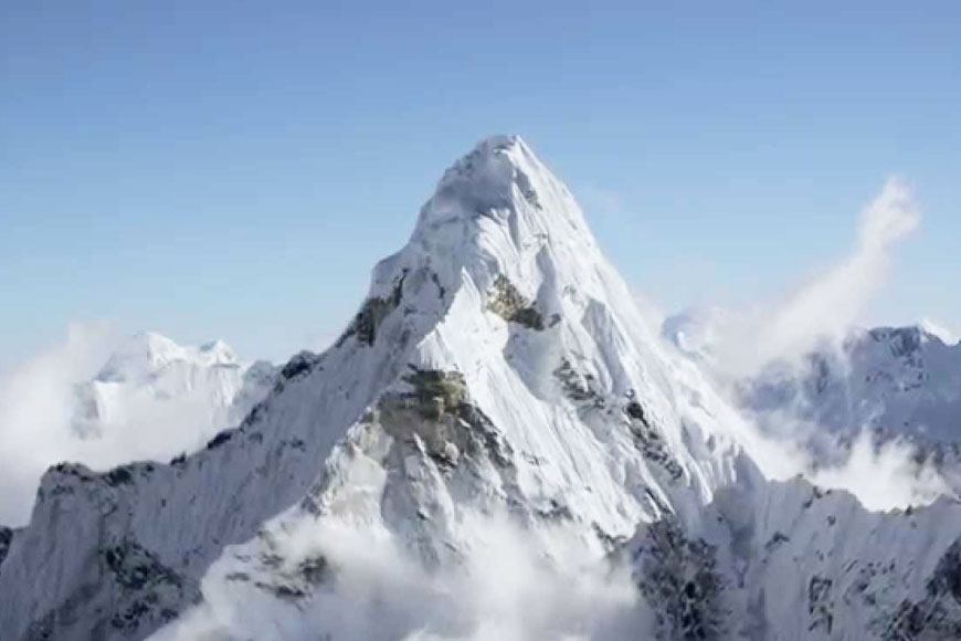
Ask any junior school kid to name the highest peak in the world and the answer will come instantly, “Mount Everest.” Yes, standing at 29,029 ft (8,848 m), it is indeed the highest peak in the world. But the present height that we know is only partially correct because according to geologists, the Himalayas continue to rise by an average of 2 cm each year. The highest mountains are only getting higher. Now doesn’t that sound enigmatic? What is the power source that is causing the rise of the Himalayas? This has been baffling the global scientific community for a long time. However, after years of groundwork, scientists are finally making headway in unlacing the riddle. Geologist Professor Santanu Bose of Presidency University has finally zeroed in on the causes behind the mystifying rise of the Himalayas and has also discovered the potential root that would put an end to the rise.
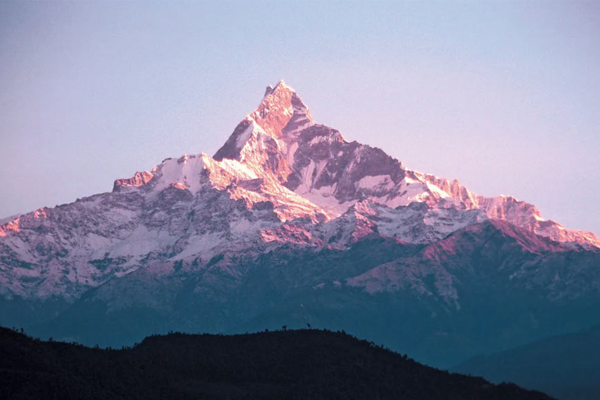
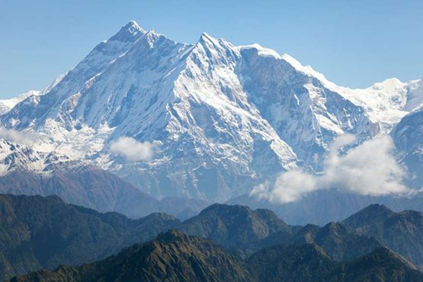
Himalayas, or the ‘abode of snow’ stretch across the northeastern portion of India and cover approximately 1,500 miles (2,400 km). The Himalayan range is made up of three parallel ranges often referred to as the Greater Himalayas, the Lesser Himalayas, and the Outer Himalayas and they pass through India, Pakistan, Afghanistan, China, Bhutan, and Nepal. Some other famous peaks of the Himalayas include Karakoram (K2), Kailash, Kanchenjunga, Nanga Parbat, Annapurna, and Manaslu.
Before we delve into the intricacies of the geological characteristics of the folded mountain and how geologists are working hard to uncover the mystery of its growth, let’s take a look at the birth of the Himalayas. Long, long ago, all the world’s landmass was connected, forming one supercontinent known as Pangea. Approximately 200 million years ago, tectonic forces broke apart this giant continent into pieces, eventually forming the continents we know today. As convection currents worked independently on the plates associated with these new continental pieces, the plates, and their respective continents began to drift across the globe to their present-day geographical locations.
Eighty million years ago, India was approximately 6400 km (3968 miles) south of the Eurasian plate. Separating the two was the Tethys Sea. The Indo-Australian tectonic plate – containing the continent of Australia, the Indian subcontinent, and the surrounding ocean – was pushed northward by the convection currents generated in the inner mantle. For millions of years, India made its way across the sea toward the Eurasian plate. As India approached Asia around 40 million years ago, the Tethys Sea began to shrink and its seabed slowly pushed upwards. The Tethys Sea disappeared completely around 20 million years ago and sediments rising from its seabed formed a mountain range. When India and Tibet collided, instead of descending with the plate, the relatively light sedimentary and metamorphic rock that makes up the subcontinent of India pushed against Tibet, forcing it upwards, and creating a massive mountain fold, the Himalayas.
Plate tectonics is a unifying theory of solid Earth sciences. In its initial form, it was a kinematic theory that described how the planet’s surface is fragmented into several rigid lithospheric plates that move in relation to each other over the less viscous asthenosphere or the upper mantle. Plate tectonics soon evolved to describe the forces that drive and resist plate movements. The Earth sciences community is now developing a new perspective that looks at plate tectonics and mantle convection as part of a single system. Why does our planet have plate tectonics, and how does it work? How does mantle convection drive the supercontinent cycle? How have tectonic-convective modes evolved over the Earth’s history? How did they shape the planet and impact life? Do other planets have mantle convection and tectonics? These are some of the fascinating questions explored by scientists.
A couple of years ago, geologist Andrew Parsons and his team from the University of Plymouth, integrated bedrock data sets, observations of subducted slabs in the mantle, and plate kinematic constraints, to constrain models for the India-Asia collision and the central Tethys oceans. They used geological tomography to propose that the Indo-Australian oceanic plate is sinking into the Sunda trench, a narrow and deep Indian Ocean region along the Andaman and Nicobar Islands that curves eastward along Sumatra and Java. This so-called subduction process is driving India’s northward movement post-collision. According to conventional plate tectonics theory, a collision between two continental plates should stop the driving force for plate motion. But the ongoing India-Eurasia convergence and the rise of the Himalayas point to a ‘mysterious’ source of energy that is activating the convergence. Their research found that the Indian continental slab had migrated 1,000 km northward through the mantle since the onset of the collision, driven by subduction of the neighbouring Indo-Australian oceanic plate. The team’s findings were published in the ‘Geophysical Research Letters.’

Meanwhile, Dr. Wouter Schellart, a renowned Professor of Geodynamics and Tectonics within the Department of Earth Sciences at the Vrije Universiteit Amsterdam, has been working on the deformation and flow in the Earth from the crustal-scale to the whole mantle scale, investigating the driving forces and resistive forces related to such deformation and flow. He uses laboratory-based (analogue) and numerical modelling techniques as well as tectonic reconstructions to quantify the deformation, velocities, forces, and stresses associated with large-scale geodynamic processes, in particular subduction and mountain building.
Taking off from where Dr. Parsons and his team left, Dr. Santanu Bose decided to proceed. Dr Bose specializes in structural geology and his areas of research interest include Structural Geology and Tectonics of Orogenic belts and Analogue and Numerical modeling. During his tenure at Monash University, Melbourne on an Australian government research fellowship, he worked with Dr Schellart, an authority in the reconstruction of tectonic processes in a laboratory. They set up an acrylic tank filled with glucose syrup in which they placed viscous silicone slabs that simulated the continental and oceanic plates, while the syrup simulated the Earth’s upper mantle upon which the plates rest. They chose glucose syrup and silicone slabs because their densities concerning each other would be similar to the densities of the continental and oceanic plates and the upper mantle. In their experiments, they initiated subduction by gently pushing a slab representing the oceanic plate into the syrup to mimic the subduction. They observed how India behaved with and without subduction. Their study pointed to the fact that the Sunda Trench is the ‘mysterious’ source of that energy which activates India’s northward movement and explains why the Himalayas continue to rise. In fact, their study also suggests that in case the Indo-Australian oceanic plate fractures into two, India’s northward push into Eurasia will stop and the rise of the mountains will come to an end.


