


The man who gave India its first map, and named Meghalaya


Meghalaya is a beautiful combination of Sanskrit words meaning ‘abode of clouds’, from Sanskrit ‘megha’ (cloud) and ‘Ä-laya’, (abode). Those who have visited this state of nearly 3.5 crore people will know that it is as beautiful as its name. And yet, not many will know that the credit for that name goes to Padma Bhusan Prof. Shiba Prasad Chatterjee, known as the “doyen of Indian geography”.
This story goes all the way back to 1972. On January 21 of that year, Meghalaya was formed by carving out two districts from the state of Assam: the United Khasi and Jaintia Hills, and the Garo Hills, the culmination of a movement for a separate hill state that had begun in 1960. The capital was going to be Shillong, a town of such picturesque charm that the British imperial authorities had nicknamed it ‘Scotland of the East’.
Post-Independence, Prof. Chatterjee was the first to propose the compilation of an Indian national atlas, containing maps of the nation’s various features. A discussion on this subject with Jawaharlal Nehru in 1953 resulted in instant approval for the project. The then Ministry of Natural Resources & Scientific Research, after consultations with other ministries, decided to set up an advisory board in March 1954 to formulate a plan for the preparation of a national atlas.
Prof. Chatterjee’s ties with the state he named were forged when, as a research student under celebrated French geographer E de Martonne, he began working on the Meghalaya Plateau. This pioneering study earned him a DLit degree from the highly prestigious University of Paris at Sorbonne, and his work was eventually published in 1936. He also obtained a Teachers’ Diploma from the University of London, and later earned a PhD in Education from the same university. Once the question of statehood for Meghalaya came up, the Government of India adopted the name that Prof. Chatterjee had coined for the Garo, Khasi and Jaintia plateau - Meghalaya.
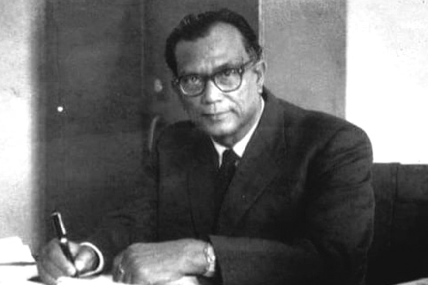 Padma Bhushan Prof. Shiba Prasad Chatterjee
Of course, the naming of a state was only one among Prof. Chatterjee’s numerous achievements. Born on February 22, 1903 in Kolkata, he is, among other things, the founder-director of the National Atlas & Thematic Mapping Organization (NATMO), and how that came about is a story in itself.
Throughout his life, his passion for teaching never left him. A brilliant academic career saw him obtain a master’s degree in Geology from Banaras Hindu University in 1926, following which he joined Rangoon University as head of the department of Geology and Geography in 1928, leaving for Europe in 1932 to pursue higher academics.
On his return to India, Prof. Chatterjee joined the University of Calcutta and introduced Geography as a discipline in the Teachers’ Training Department, and subsequently at the Honours and Masters levels in 1939 and 1941 respectively. He took charge of the Geography Department as professor and head, and remained attached to it throughout his life, serving as Emeritus Professor after his retirement in 1967.
Simultaneously, he was working to establish a national geographical society, and Calcutta was chosen as an appropriate place to start. Thus, the Calcutta Geographical Society, now known as the Geographical Society of India, came into being in 1936.
Post-Independence, Prof. Chatterjee was the first to propose the compilation of an Indian national atlas, containing maps of the nation’s various features. A discussion on this subject with Jawaharlal Nehru in 1953 resulted in instant approval for the project. The then Ministry of Natural Resources & Scientific Research, after consultations with other ministries, decided to set up an advisory board in March 1954 to formulate a plan for the preparation of a national atlas. The board was in favour of the plan, and provided a tentative guideline of the scope and contents of the atlas.
In April of the same year, the ministry sanctioned seven temporary staff members to help Prof. Chatterjee implement the board’s suggestions. The order also sanctioned the creation of an additional 56 temporary posts, and Prof. Chatterjee was appointed honorary director of the project. The institution thus created was named National Atlas Organization, and its first home was the Geography Department of Calcutta University. In 1978, the name of the organization was modified to National Atlas and Thematic Mapping Organization.
Prof. Chatterjee’s ties with the state he named were forged when, as a research student under celebrated French geographer E de Martonne, he began working on the Meghalaya Plateau. This pioneering study earned him a DLit degree from the highly prestigious University of Paris at Sorbonne, and his work was eventually published in 1936. He also obtained a Teachers’ Diploma from the University of London, and later earned a PhD in Education from the same university.
His work in Bengal was no less revolutionary, beginning with a map of Bengal showing the distribution of population according to religions, which was later published by Survey of India. He was also the first Indian geographer to carry out a complete land use survey of Howrah district in 1950.
His pioneering work titled ‘Bengal in Maps’ had been published soon after the Partition of India in 1947. He also contributed the chapter titled ‘Himalayan Mountain Ranges’ in the New Encyclopaedia Britannica, not to mention authoring several geography textbooks. His last venture before his death in 1989 was a comprehensive volume titled ‘Economic Geography of Asia’.
As one of India’s foremost geographers, Prof. Chatterjee also became attached to various international events related to geography and cartography (the science of map-making) throughout his life, and attended the International Geographical Congress at Washington D.C in 1952. He was elected vice-president of the International Geographical Union (IGU) at its Congress in Stockholm in 1960, and at the subsequent international Geographical Congress in London, was elected president of IGU for the term 1964-68.
Padma Bhushan Prof. Shiba Prasad Chatterjee thus deserves to be remembered not merely as a geographer or cartographer, but as a path-breaking educator and adventurer, who showed us how to take the roads less travelled.


