


A walk down Sealdah and Bowbazar, among the oldest areas of Kolkata

Our weekly walk has brought us to what is one of Kolkata’s most fascinating neighbourhoods, though we perhaps do not think of it as such. Sealdah, intrinsic to the growth of the city. Once upon a time, it bordered the Salt Lakes, as well as the creeks and mangrove forests that formed the Sundarbans. Over the centuries, of course, the mangroves have been pushed hundreds of miles further back, and Sealdah is just another busy neighbourhood. From here, we will continue on to Bowbazar Street, yet another fascinating remnant of old Calcutta.
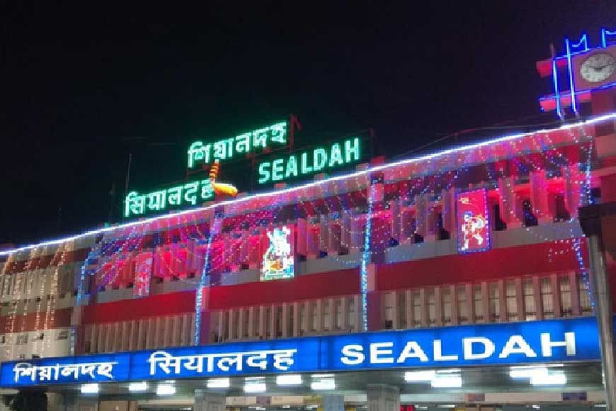
Point A - Sealdah
The name apparently comes from ‘srigal’ or ‘shiyal’ (Bengali for jackal), herds of which once roamed the area. In his writings about old Calcutta, historian P. Thankappan Nair has observed that in its earliest stages, the city was a collection of raised islands surrounded largely by marshland. He felt the name Sealdah derived from ‘Shiyaldihi’, where ‘dihi’ meant village. Just in case you needed reminding, among the territories which came under Calcutta was a collection of 55 villages called ‘Dihi Panchannagram’, and Panchannagram is still the name of a neighbourhood located off the EM Bypass.
The original Sealdah formed a gateway of sorts to the Salt Lakes, which roughly corresponds to Salt Lake of today, and the Sundarbans. In the first half of the 1700s, Sealdah formed a causeway intersected by the ‘Marhatta Ditch’, the protective moat built in 1742, which partially circled the settlement of Calcutta to keep Maratha raiders out. This ditch was later filled up to form Upper and Lower Circular Roads (now APC Road and AJC Bose Road respectively).
Around 1857, Sealdah first became a hub for the railway lines joining the eastern and southern parts of the province of Bengal. The first line to open up on this route was the one running from Sealdah to Kushtia in erstwhile East Bengal. In 1862, another line opened up to Port Canning, operated by the Calcutta and South Eastern Railways. Today, Sealdah is known as the busiest railway junction in Asia, but few traces of its history remain.
Point B - Church of Our Lady of Dolours
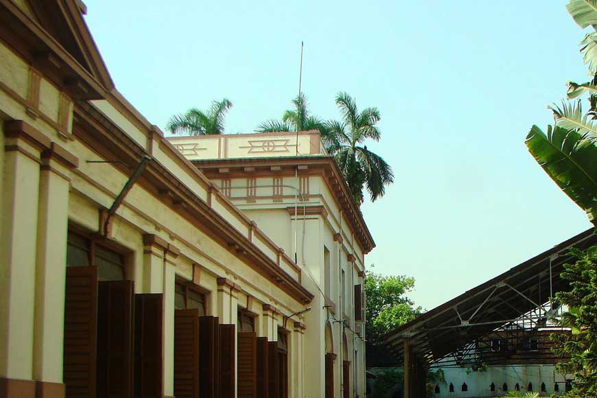
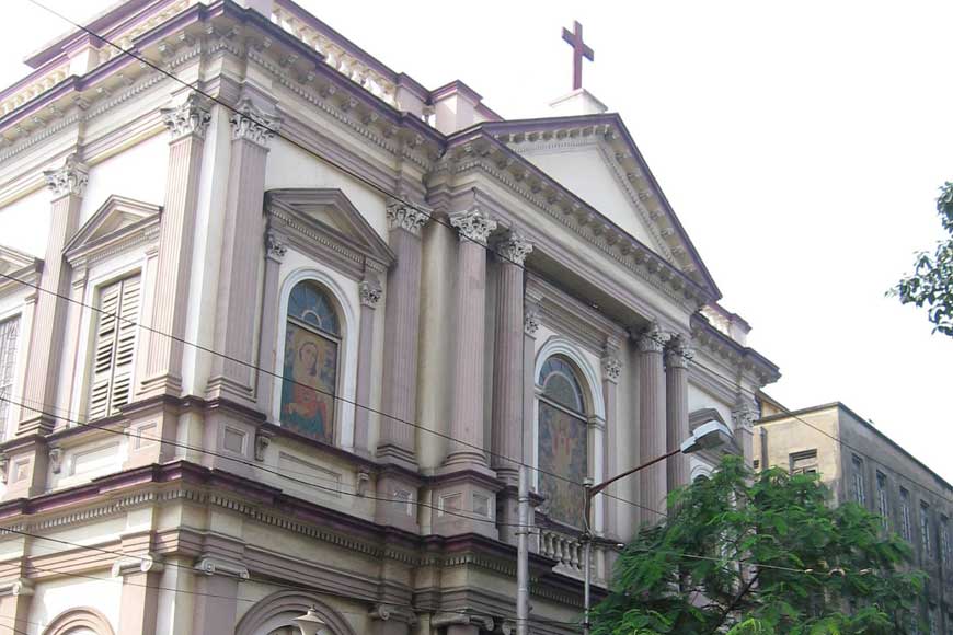
When you reach the base of Sealdah Flyover, turn left and walk past a few shops to reach Our Lady of Dolours (mistakenly called Church of the Lady of Doris by some chroniclers). Its official address is 147, BB Ganguly Street, Koley Market. The church was apparently built in 1809 courtesy the funds provided by one Mrs Garcia Elizabeth, for use of the indigenous Christians in the area, particularly the Goans. The simple yet impressive building is interesting primarily as a piece of living history, and still holds regular services on Sundays, as well as Mass. Also interesting is the reported sepulchre (a small room or monument, cut in rock or built of stone, in which a dead person is laid or buried) of St Francis Xavier, kept in a niche to the left of the altar.
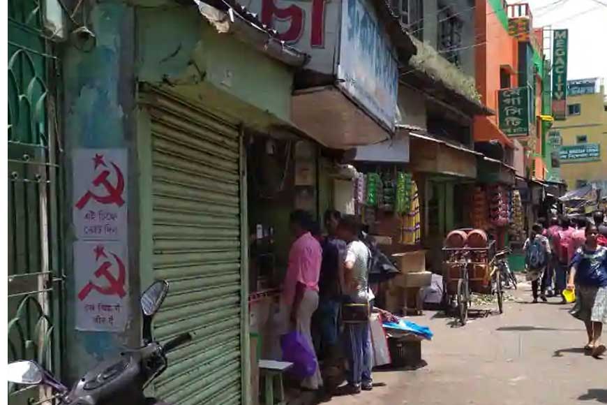
Point C - Baithak Khana Bazaar
‘Bytaconnah’ is how the British pronounced the name of this age-old bazaar, marked out in maps as early as 1758. How this name originated is not entirely clear, though some say the source was a large bungalow of unknown ownership, probably built around 1740. One other theory is that merchants and traders from the Salt Lakes and Sundarbans congregated beneath an old and spreading banyan tree, and held regular ‘baithaks’ or sit-ins. In fact, some accounts of old Calcutta also have Job Charnock sitting beneath the tree with his hookah, settling disputes and interacting with the populace.
The bazaar itself is a fascinating walk through, offering the widest range of commodities possible, including several varieties of dried fish.
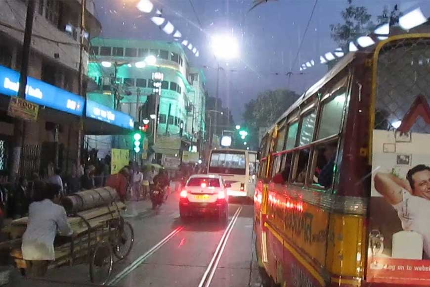
Point D - Bowbazar Street
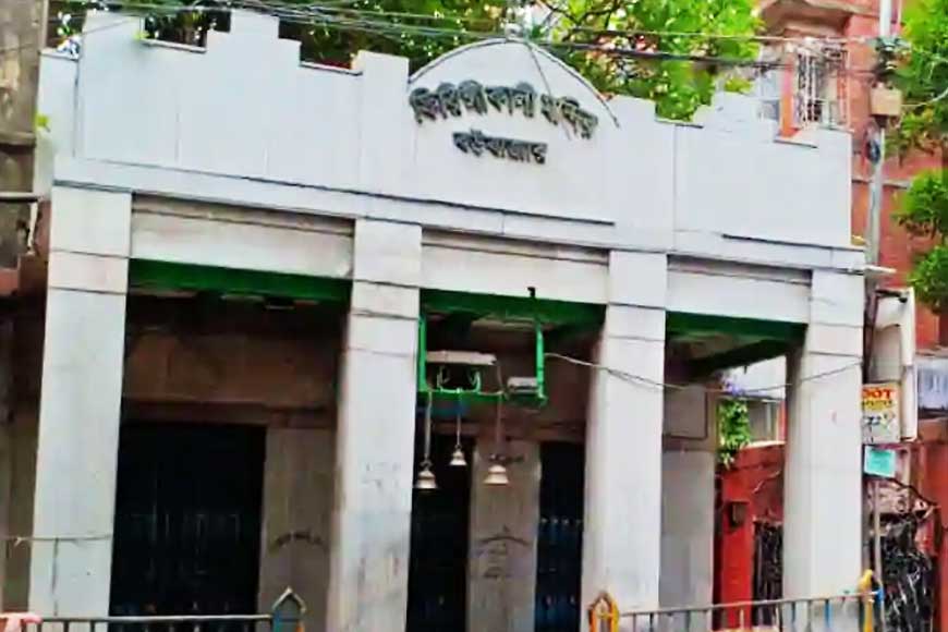
Of course, this is the road we know as Bipin Behari Ganguly Street. ‘Boubazar’ in Bengali, the name of this street probably came from ‘bahu (many) bazaar’, though as is always the case when a source is shrouded in the mists of time, there are alternative theories that the name comes from the ‘bou’ or daughter-in-law of Shovaram Bysack (Basak), whose rath (chariot) carrying Lord Jagannath was drawn along this road, or th daughter-in-law of Biswanath Motilal, the Dewan of the Salt Golahs (large stacks). Said to have been constructed around 1749, Bowbazar Street is easily accessed from Sealdah, and on the way, you will pass the somewhat bizarrely styled building of Basumati Sahitya Mandir, a heavily ornamented mishmash of native and Western architectural fashions. A publishing house set up by Upendranath Mukhopadhyay in 1881, Basumati Sahitya Mandir was the source of two important publications - the Saptahik (weekly) Basumati and Dainik (daily) Basumati.

You will now come upon row upon row of jewellery shops, quite unique in their sheer numbers and variety. Leading off from the main road is Refuge Lane, where craftsmen sit in dark, dingy workshops, hunched over small flames, crafting gold jewellery following age-old methods.
Read the earlier episodes of our walk :
Enjoy the lockdown with your very own customised Kolkata Walk
A little bit of BBD Bag, a whole lot of Calcutta
Esplanade, the beating heart of old Calcutta
The places of worship in old Calcutta, and what we learn from them
Walk on for a perfect balance of religion and commerce
On the waterfront: a walk along the Hooghly
Walking around the ‘native’ palaces of Kolkata
Also leading off from Bowbazar Street is Madan Dutta Lane, where you will find a couple of graceful but rundown old residences belonging to the Sils, most probably dating back to the early and mid-1800s.
Point E - Church of St Xavier’s, Indian Association, Firingi Kalibari
Initially built as a chapel in 1881, this church was badly damaged by an earthquake, and the new Francis Xavier’s Church was founded in 1898, with the foundation stone being laid by then Archbishop Paul Goethals. What is of real interest in this church is a plaque at the back of the hall, mentioning the Marquis of Ripon (Governor-General of India from 1880-84) as one of the founders. Abandoning the Anglican Church of England, Ripon had converted to Roman Catholicism, and for this reason was held in contempt by many of his peers.
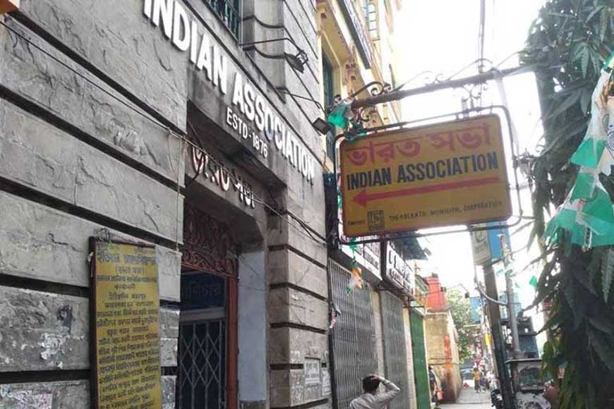
A little further on is the Indian Association Building built in 1876, renowned as an early nerve centre of the Indian Nationalist movement. This is the building which saw the likes of Rashbehari Ghosh and Surendra Nath Banerjee address party workers as they planned their movement, and several remarkable quotes by nationalist leaders have been etched on marble plaques in the front of the building.
Diagonally opposite the Indian Association is the legendary but unpretentious Firingi Kalibari, apparently constructed and consecrated in the Bengali year 905, if the tablet set into its front is to be believed. That would make this Kali temple over 500 years old, but it appears to have acquired its name during British rule, when it was frequented as much by Europeans as by natives, giving rise to the moniker of ‘Firingi’ (vernacular for foreigner) Kalibari. However, the other theory is that the temple was named after Antonio Cabral (who became Antony Kabiyal for the locals), a noted Portuguese balladeer of the 18th century, who had ‘gone native’ to the extent of becoming an ardent devotee of Kali.
Point F - Metcalfe Street
Approaching the end of our walk, check out the Carey Baptist Mission Church, named after William Carey, the great Indophile and social reformer who came to India in 1790 on missionary work, but became deeply involved in local issues and problems, and grew so proficient in Bengali that he brought out the Bible in Bengali in 1801, and edited the first Bengali newspaper, Samachar Darpan. His printing press in Serampore also pioneered the use of Bengali block print. As if all this was not enough, Carey was also the driving force behind the setting up of the Royal Agri Horticultural Society in 1820, which remains a thriving organisation even today.
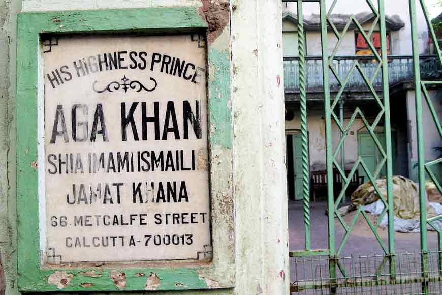
From the Mission Church, a left turn on to Metcalfe Street will bring you to a house belonging to Aga Khan, the head of an Ismaili sect of Muslims. Diagonally opposite is the Parsi fire temple, more properly known as the Anjuman Zoroastrian Atish Adaran, one of four fire temples in and around the city.
Next week, we will walk down the literal centre of Kolkata, Central Avenue.


